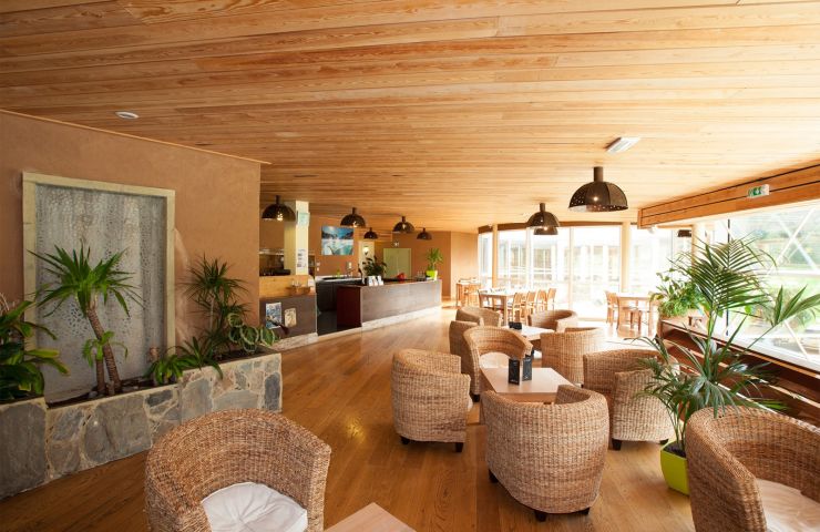
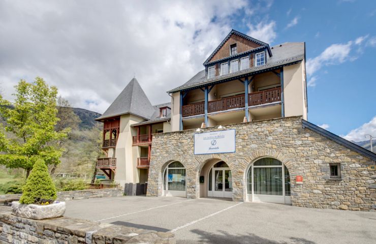
Mercure, two exceptional 4* hotels that offer a unique experience in the Hautes-Pyrénées
Mercure, two exceptional 4* hotels that offer a unique experience in the Hautes-Pyrénées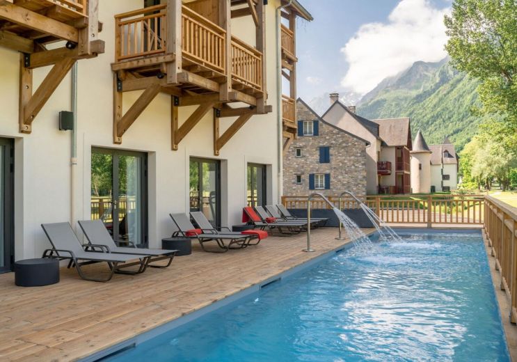
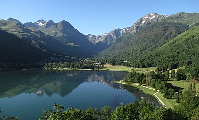
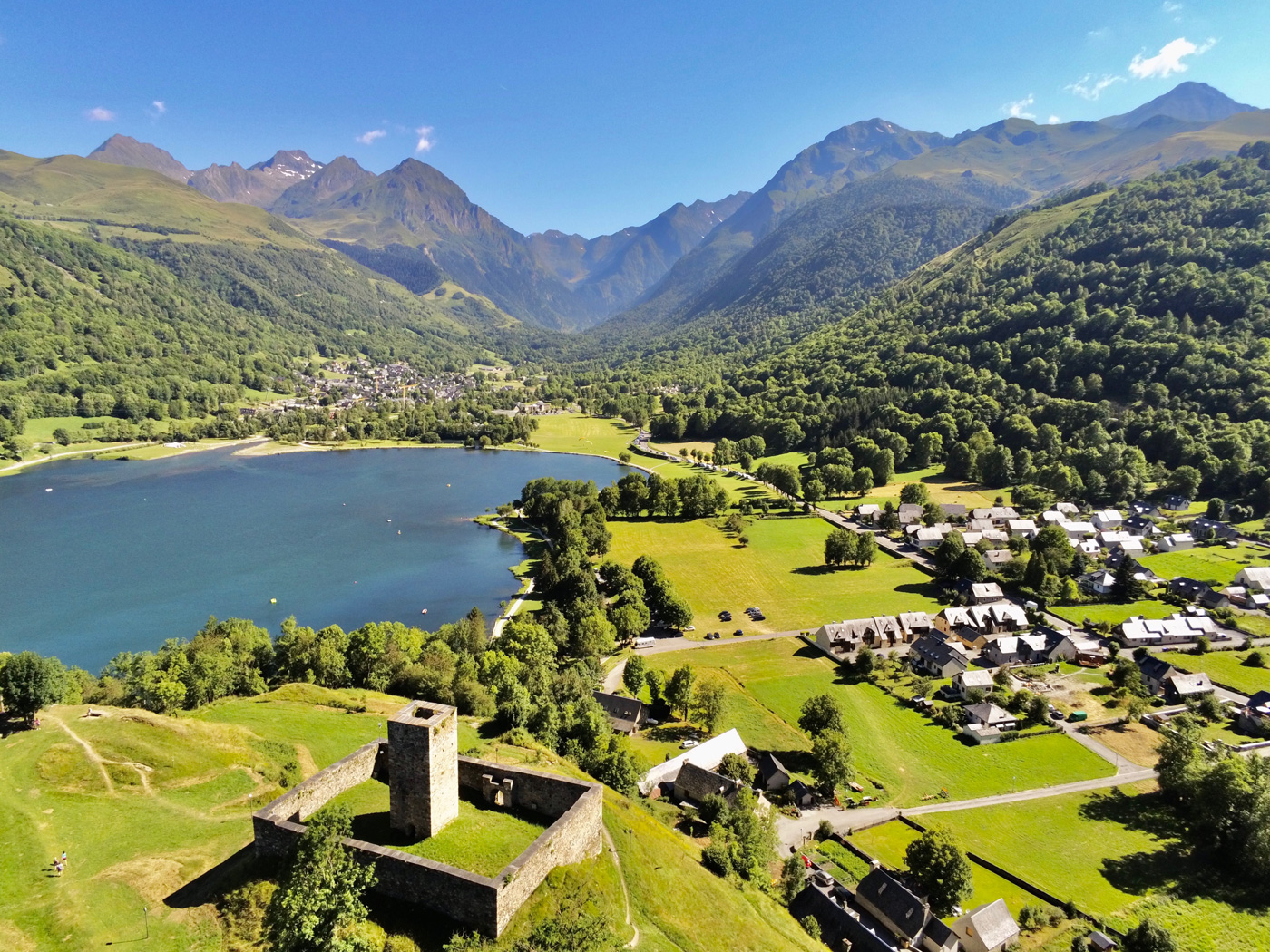
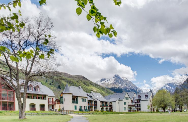
Loudenvielle
Weekend & Holidays


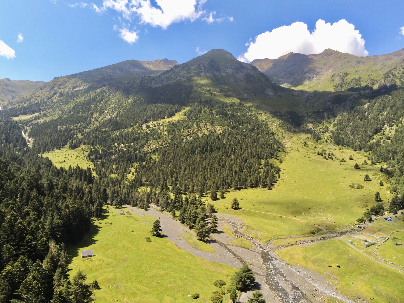
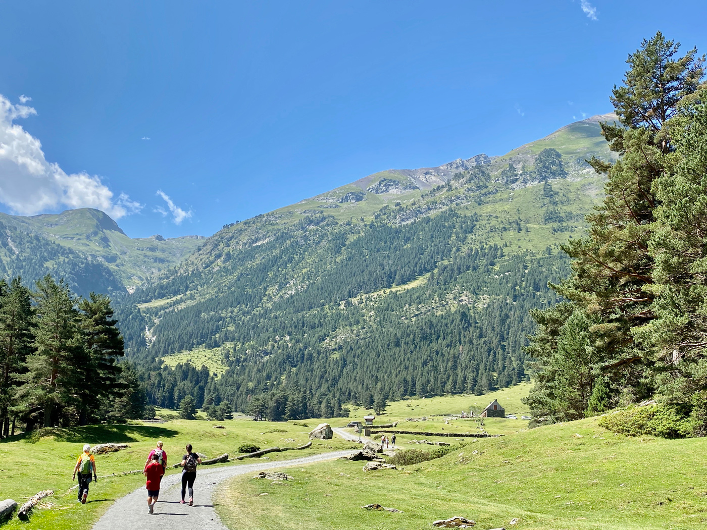
Do you love the Pyrenees ? The best way to get closer to its snow-capped peaks, emerald lakes and picturesque flora and fauna is to explore them on foot. Here are 4 hiking ideas, accompanied by sumptuous photos and well-informed advice, to allow you to enjoy the Pyrenees in complete peace, with family or friends. Don't forget sunscreen, hiking shoes, a picnic and let's go!
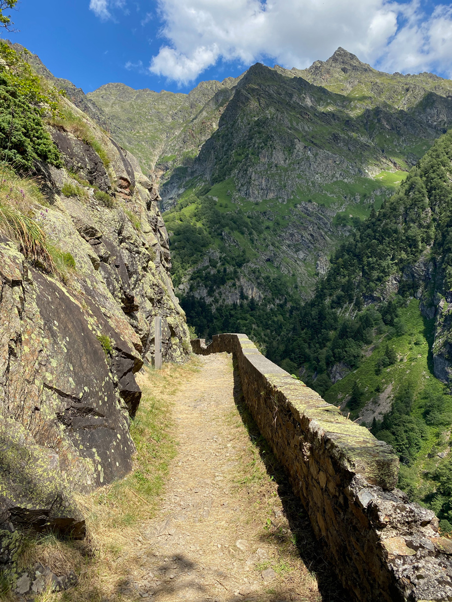
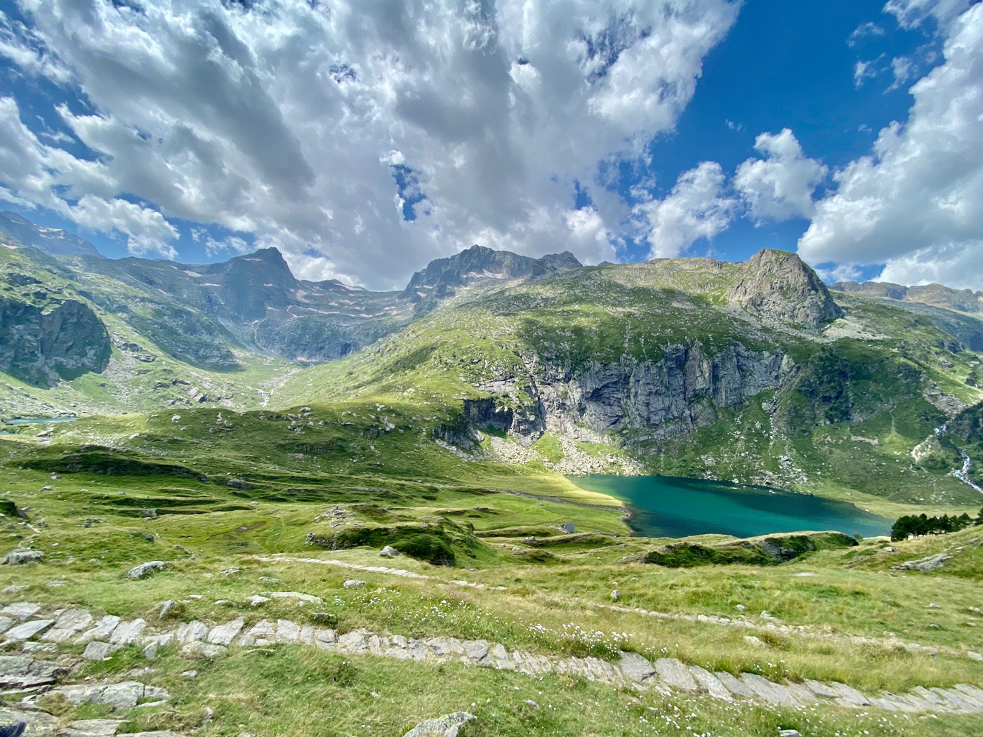
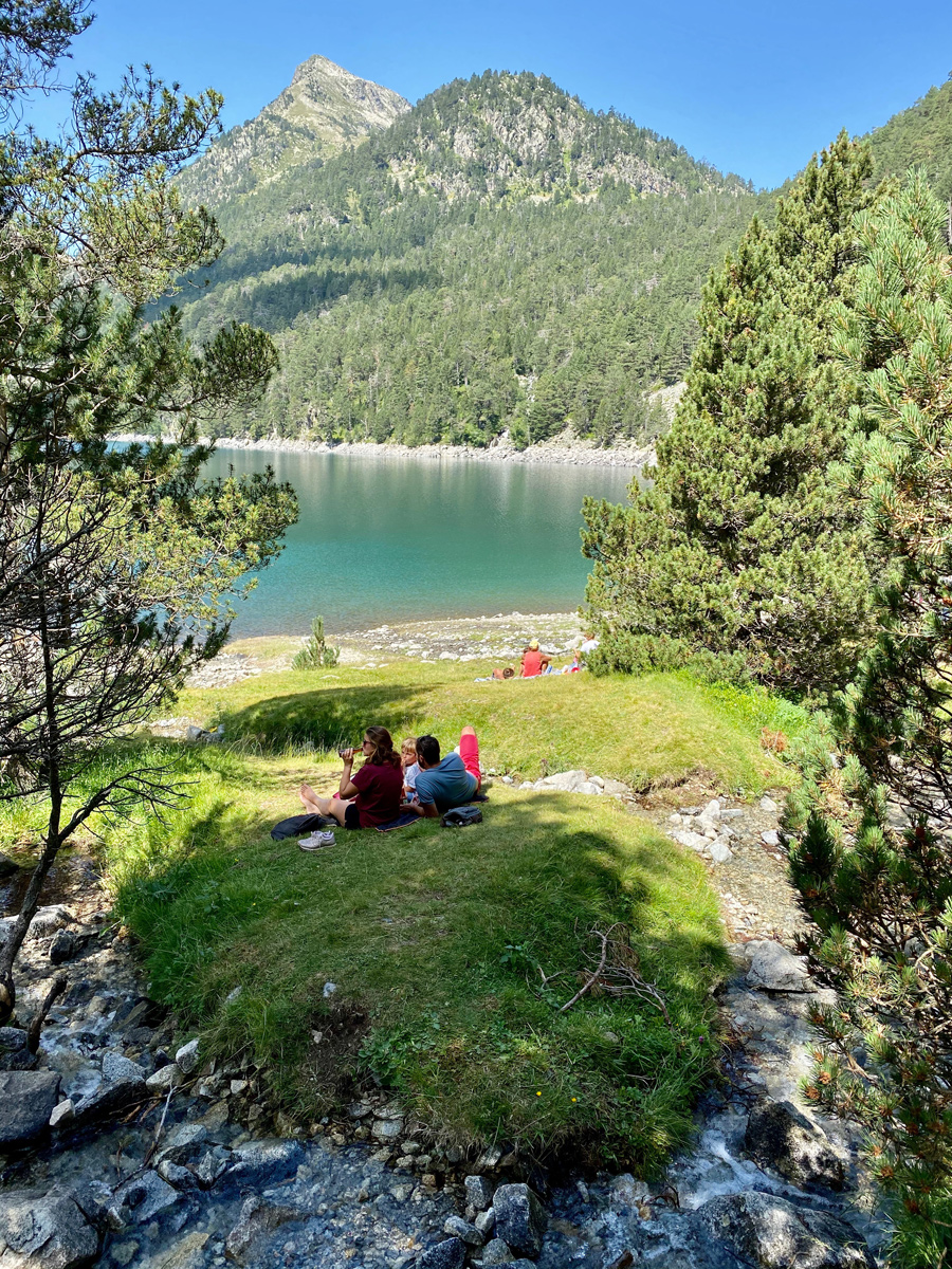
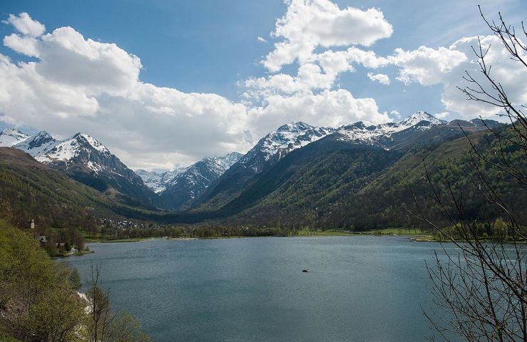
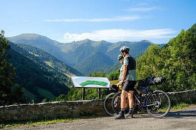
During your stay in the pretty Louron valley, and after visiting the magnificent village of Loudenvielle and its picture-postcard lake, you can extend your route in the upper valley, to the Pont de Prat, located at an altitude of around 1200m.
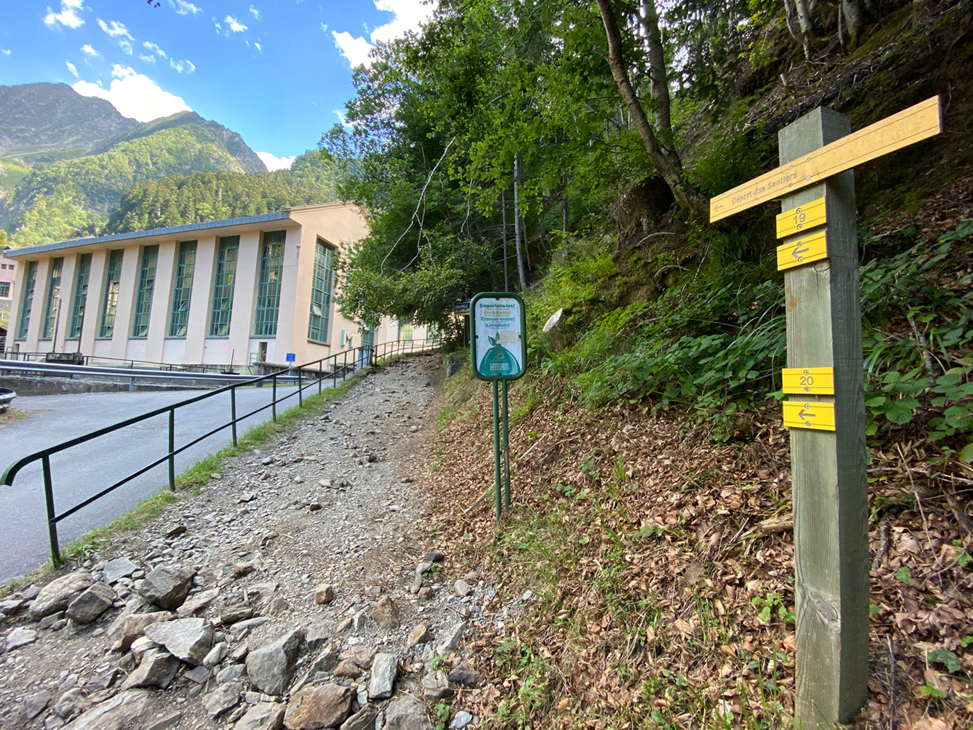
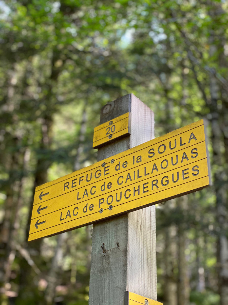
Once parked near the hydroelectric power station, you take the stony path on the right leading you to the first slopes of Soula.
This hike is done in 3 stages:
Duration: Approximately 1.5 hours to the Soula refuge. + 1.5 hours to Lake Caillauas.
Elevation gain: Approximately 400m to the refuge. +500m from the Soula refuge to Lac de Caillauas.
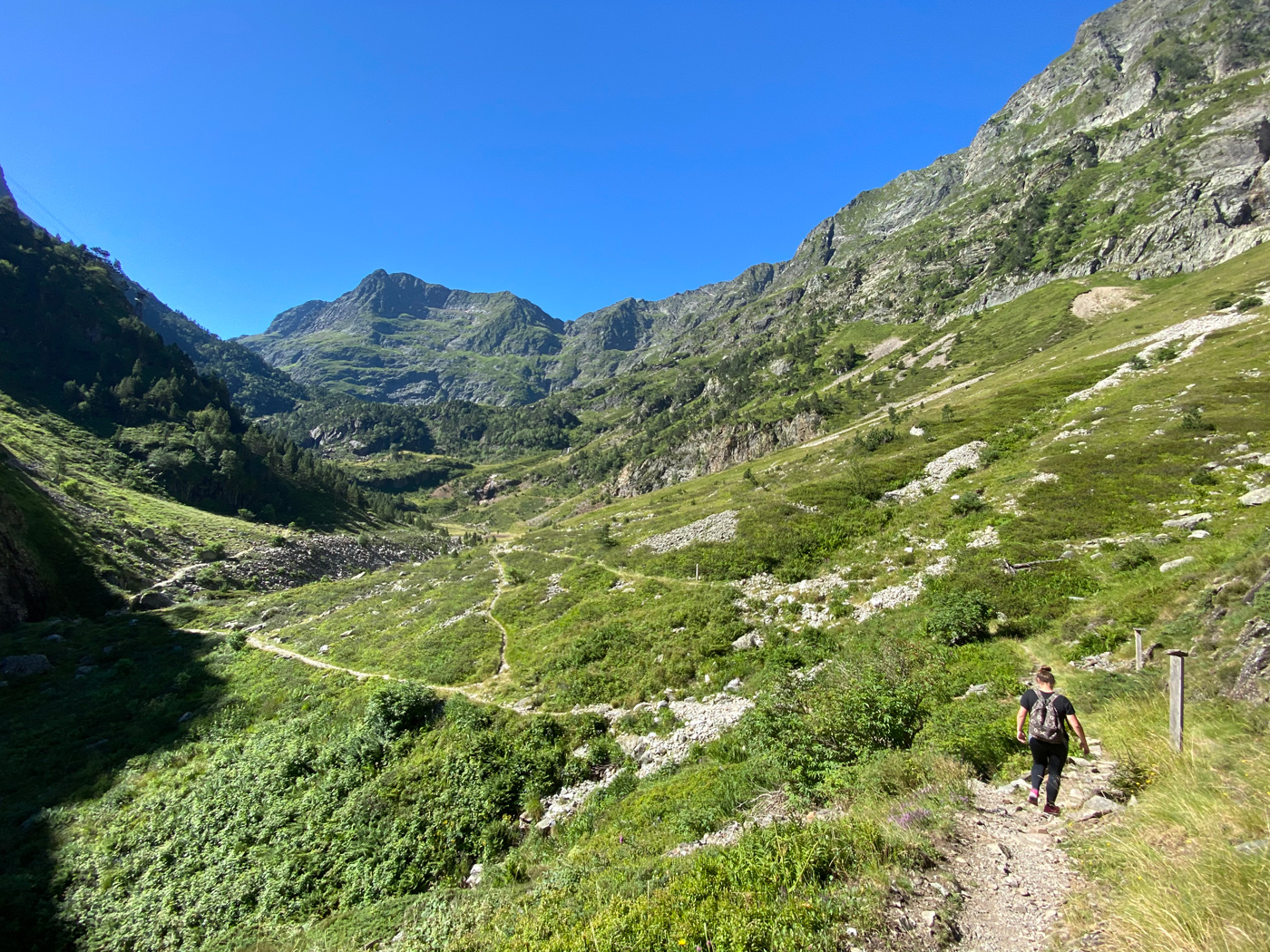
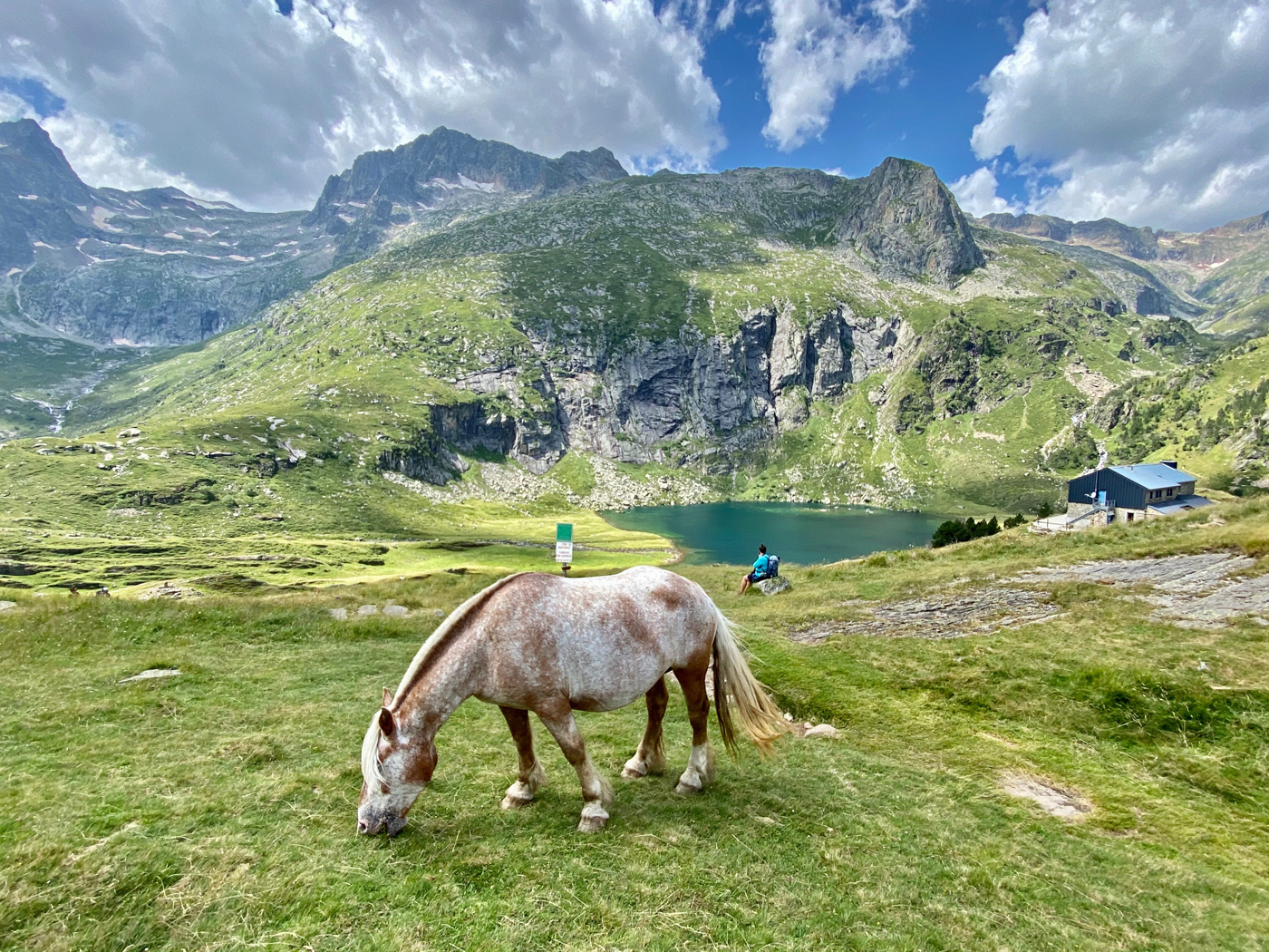
Arrival at the Soula refuge
A final effort to reach the sumptuous Lac de Caillauas
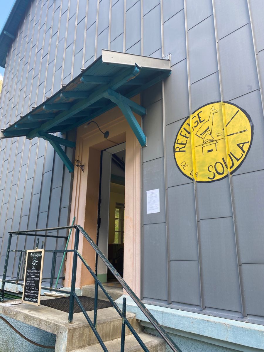
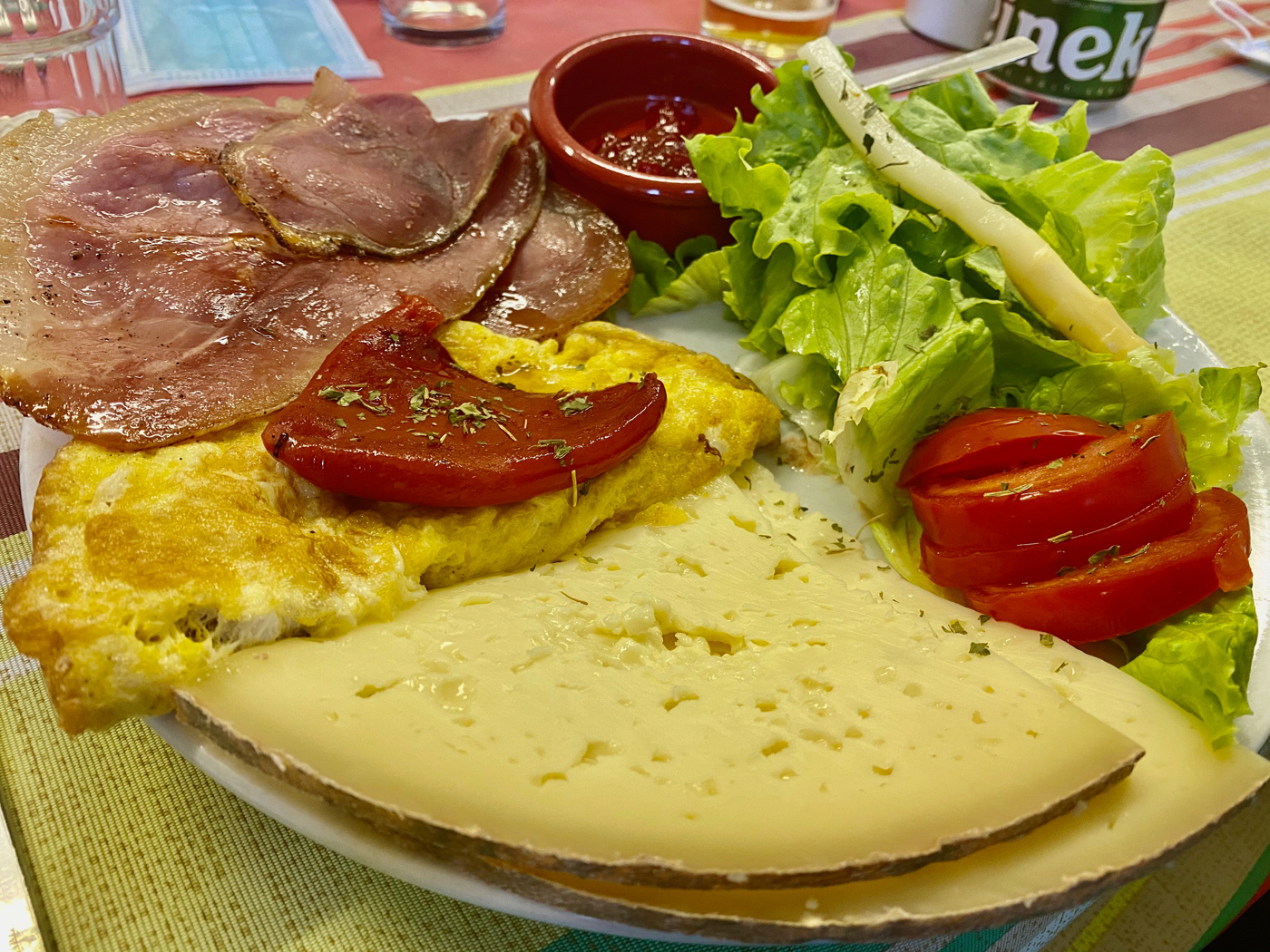
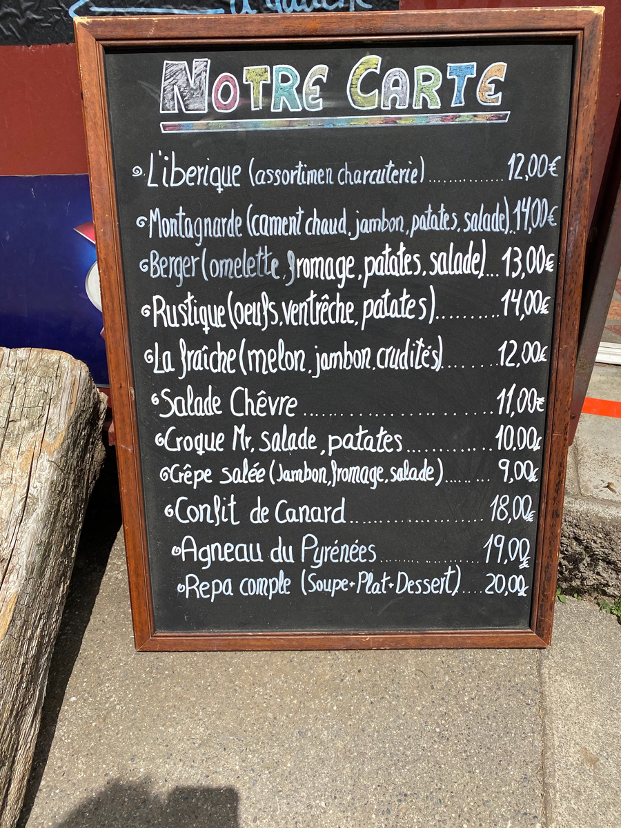
An effort that deserves a gourmet comfort at the Refuge de la Soula!
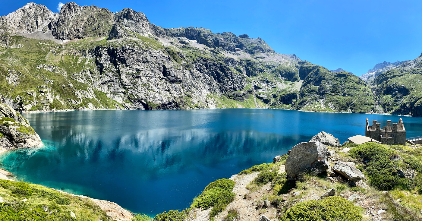
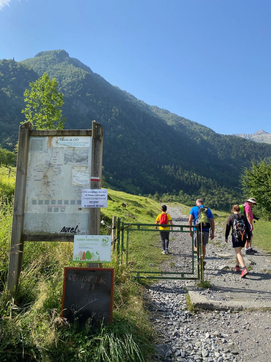
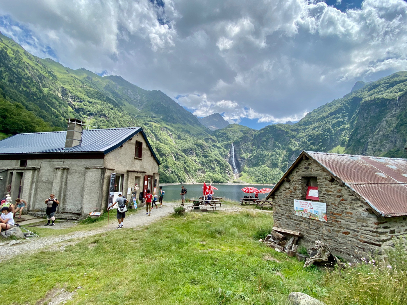
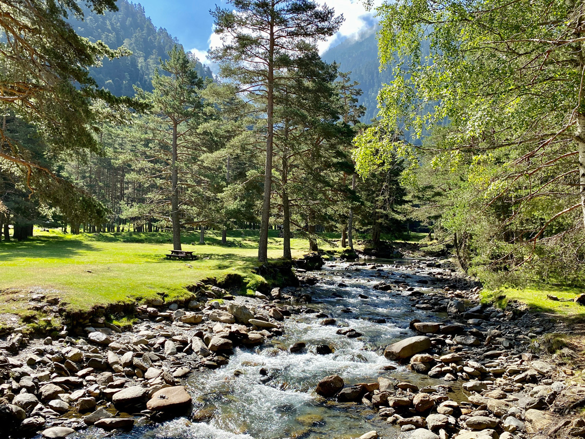
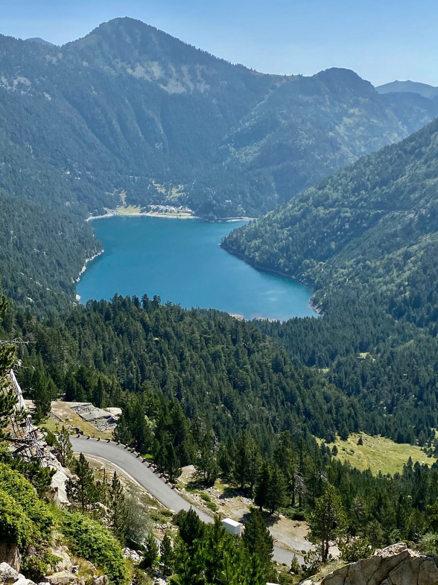
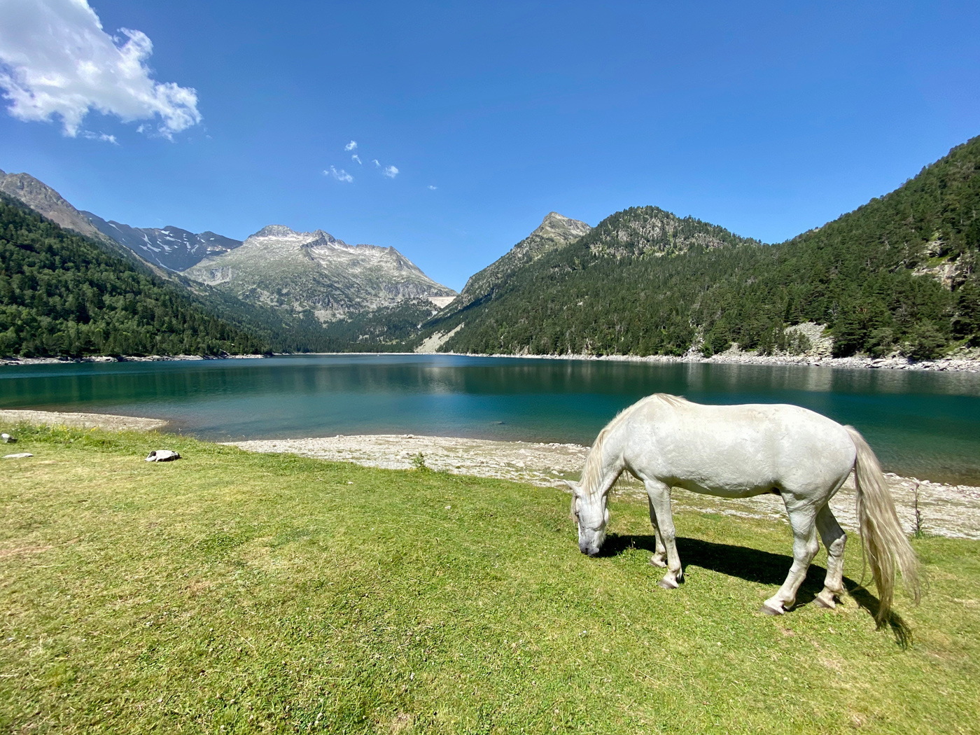
The hike to the famous Lake Oô is a classic of its kind, to be done with good shoes and a camera to bring back a souvenir of this majestic natural spectacle.
The climb is mainly in the shade and the arrival at the lake offers you a magnificent spectacle, the waterfall in the background adds a spectacular side to this typical view of the Pyrenees.
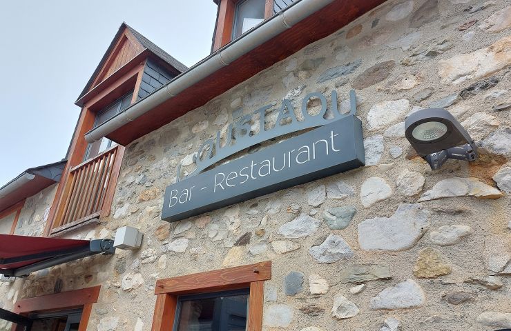
L'Oustaou, a quality mountain restaurant for relaxing in the Hautes-Pyrénées Whether it's skiing in winter or ...
330 m - Loudenvielle
Mercure Hotel Peyragudes Loudenvielle, a restaurant serving local cuisine in the Pyrenees What a pleasure to be able ...
420 m - Loudenvielle
TAKEAWAY AVAILABLE from 12 p.m. to 2 p.m.! Because there is no well-being without pleasure of the palate, Balnéa ...
586 m - Loudenvielle
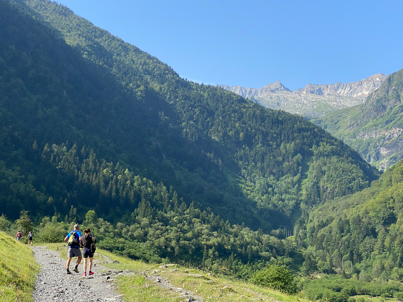
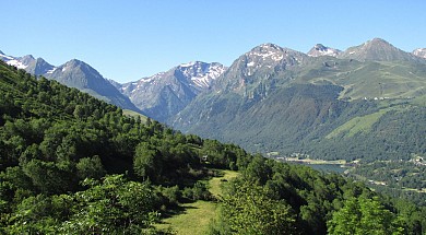
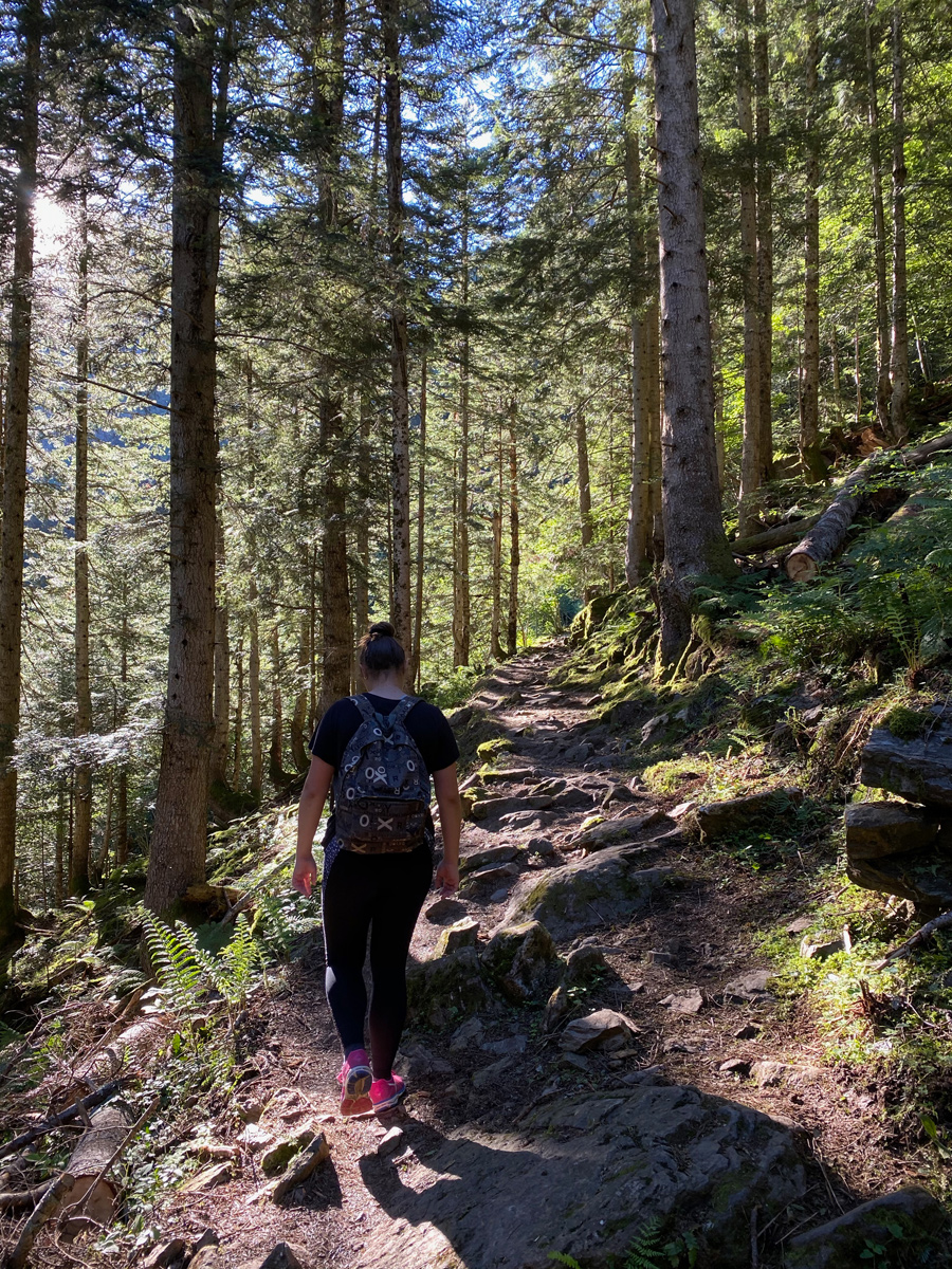
Walk along the valley with its conifers and its panorama
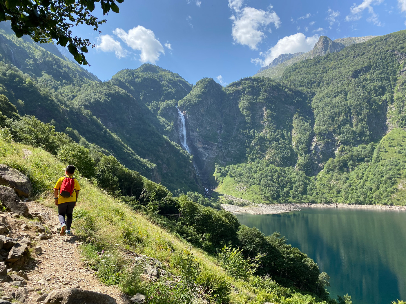
Lake Oô and its spectacular waterfall!
If you wish to extend your hike to Lake Espingo, which is located one level above Lake Oô (but what a level!), you must take, just before arriving at Lake Oô, the path which climbs to the left of the lake.
All you have to do then is descend quietly through the pastures to reach the lake and enjoy a well-deserved rest!
Duration: Approximately 1 hour to Lake Oô. + 1 hour 15 minutes to 1 hour 30 minutes depending on your fitness for Lake Espingo.
Elevation gain: Approximately 350m to Oô. + 400m to Espingo.
Located 150 km from Toulouse and 70 km from Lourdes, in the heart of the unspoiled Louron Valley, renowned for its ...
335 m - Loudenvielle
Located 150 km from Toulouse and 70 km from Lourdes, in the heart of the unspoiled Louron Valley, renowned for its ...
335 m - Loudenvielle
Mercure Hotel Peyragudes Loudenvielle, a wellness rental where you can relax in the Pyrenees In the heart of the ...
416 m - Loudenvielle
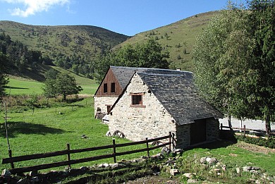
Here is a peaceful, family-friendly hike in a picture-postcard valley! Leaving Saint- Lary Soulan, head towards the Bielsa tunnel, then after about 5km, turn left towards the village of Tramezaigues. After a climb by car of about 8km, you reach a shaded parking lot on the edge of the torrent, which is the starting point for many hikes in the magnificent Rioumajou valley.
Today's hike takes us peacefully towards the Hospice de Rioumajou, along a superb torrent, in a truly postcard-perfect setting!
The climb is gentle, the path wide, so much so that a few vehicles sometimes come to take us out of our contemplative state!

Duration: Approximately 1 hour to the Hospice de Rioumajou.
Elevation gain: Approximately 200m
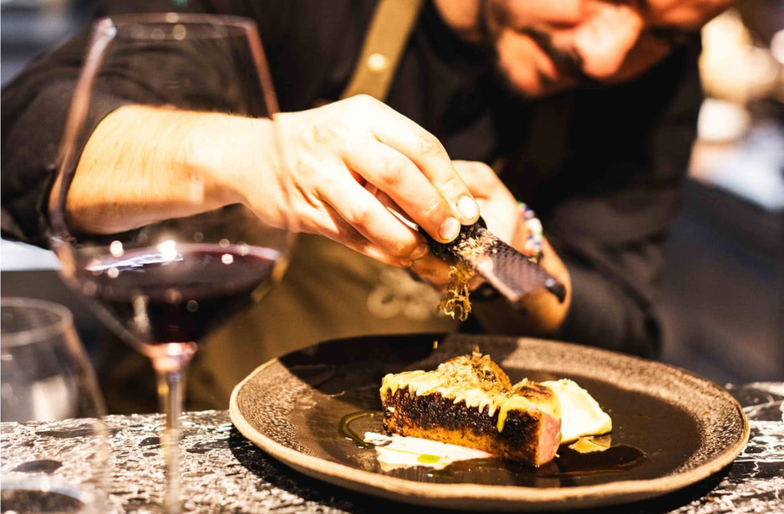
“L’Ours” in the local dialect, a restaurant deeply rooted in its region that puts the Aure Valley at the heart of every dish. Open for lunch and dinner from Wednesday through Sunday, L’Ors invites you to escape into a world of natural, rustic cuisine where tradition and modernity blend seamlessly. Reserve your table and take a bite into the heart of the mountains.
This little gastronomic gem pays homage to its region through vibrant cuisine that follows the rhythm of the seasons and features wild foraged plants. Each ingredient, selected at local markets or directly from nearby producers, is carefully prepared to offer you a unique taste of the region. The concise menu promises precision and authenticity in both flavor and presentation, while the set menus allow you to appreciate the elegant craftsmanship of a creative and passionate chef.
L’Ors offers an immersive experience in the heart of the mountains. The cuisine, featuring local flavors, is in perfect harmony with the spirit of this refined restaurant, where the bear motif appears in subtle details. While the dining room exudes warmth with its wooden furniture and velvet armchairs, the small lounge is also a popular spot for sipping a cocktail or savoring sweet treats. In the warmer months, the terrace is a must-visit, offering a splendid view of the mountains—an exceptional setting for a unique gastronomic experience.
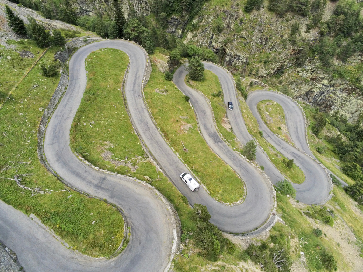
Taking a trip along the road to these high mountain lakes is, for me, a must-do in the region. Leaving Saint-Lary towards Spain, you take the D118 and, before Aragnouet, you turn right onto the D929. The road which then winds through a deep wooded valley is magnificent. It is the starting point for several hikes in the magnificent Massif de Néouvielle.
At the bottom of the valley, the climb becomes more spectacular when you take the pretty and picturesque Edelweiss hairpin bends, which mark the arrival at Lake Orédon.
You then have two options:
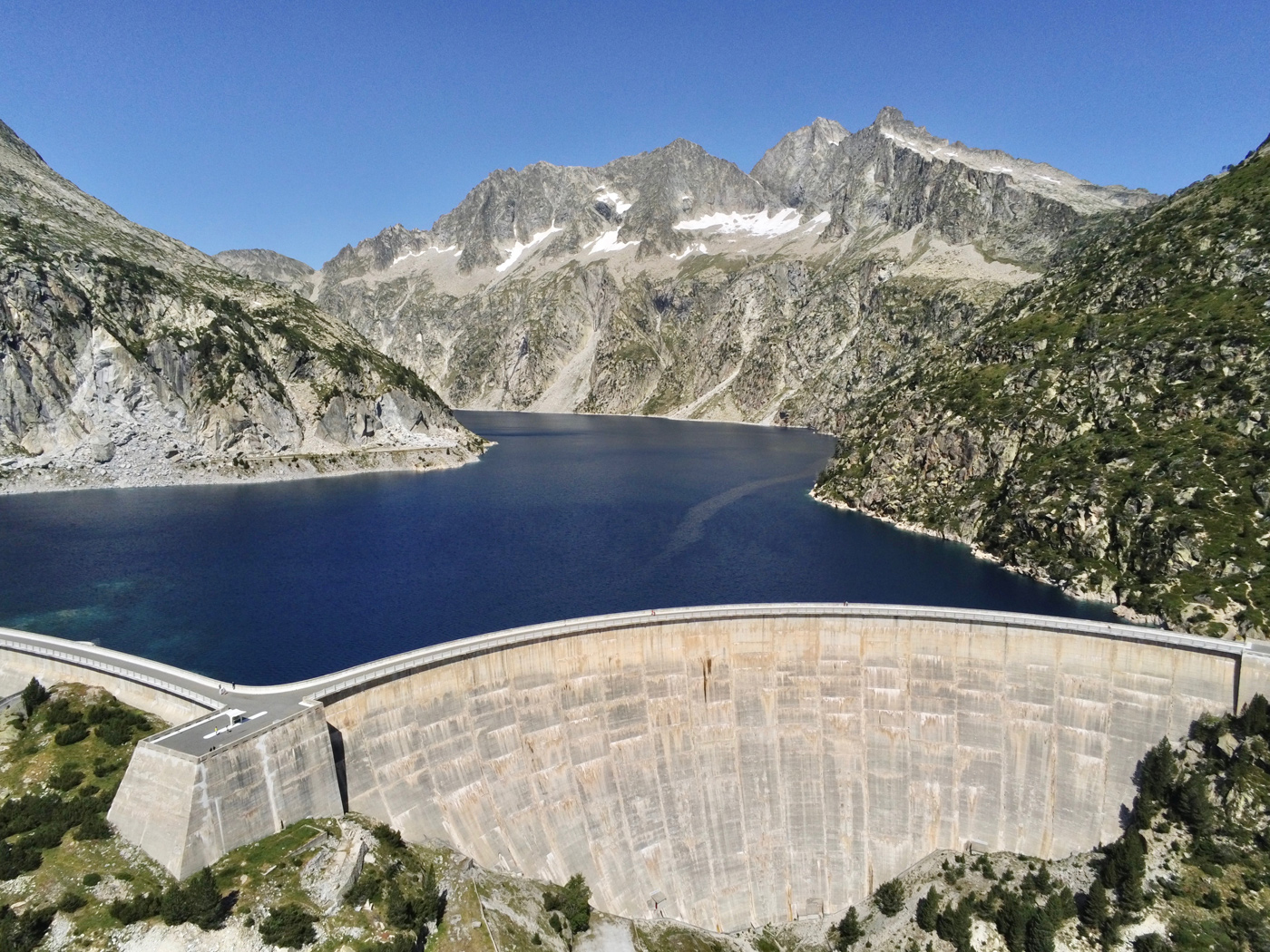
The Cap de Long lake is extraordinary in every way. It is the largest reservoir in the Pyrenees and the most imposing dam, at 101m high!
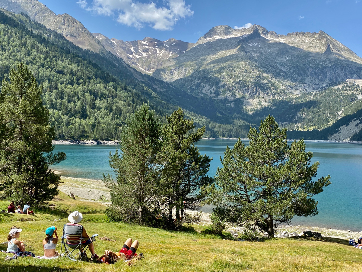
As for the road leading from Lake Orédon to Lake Aumar and Lake Aubert, located at an altitude of almost 2,200 m, the latter is now closed to traffic for a large part of the day in summer (from 9:30 a.m. to 6 p.m.), which is a great benefit for nature.
You can take the hiking trails that lead to the discovery of these high-altitude lakes. Here, the routes abound. One of our favorites is the "Orédon, Aubert, Aumar" loop, 3 hours round trip and a positive elevation gain of around 350m which will allow you to appreciate these three magnificent lakes!
Did you like our article? Find more on our BLOG ! Follow us on the Toulouse Pyrénées Guide Facebook page, and also on our Instagram account @guidetoulousepyrenees
Loudenvielle
Weekend & Holidays
Loudenvielle
Weekend & Holidays

Loudenvielle
Weekend & Holidays

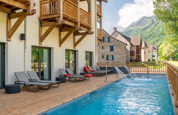
Loudenvielle
Rest and relaxation
Loudenvielle
Weekend & Holidays

Loudenvielle is a small haven of peace nestled in the heart of the mountains in the Hautes-Pyrénées. This charming ...
315 m - Loudenvielle
Loudenvielle is a small haven of peace nestled in the heart of the mountains in the Hautes-Pyrénées. This charming ...
571 m - Loudenvielle
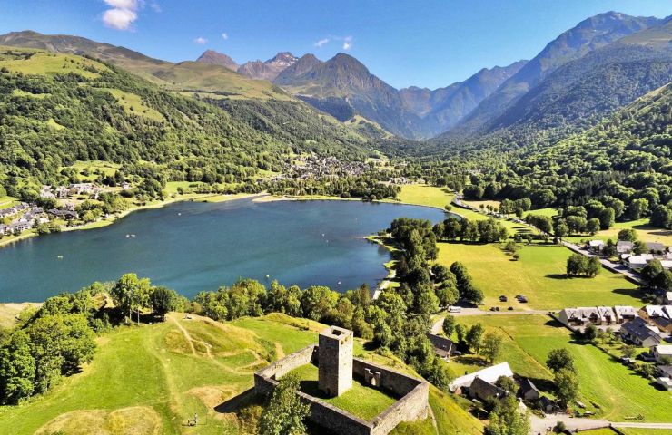
A superb lake in the heart of the Louron Valley, accessible by car. You are at the foot of the Val Louron and ...
1,2 km - Génos
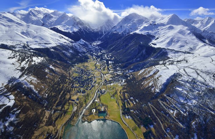
The two high-altitude villages of the Peyragudes resort are now connected to the valley village of Loudenvielle. ...
2,4 km - Germ
Saint-Lary-Soulan is an emblematic mountain resort in the Pyrenees, located in the Hautes-Pyrénées department. A ...
7,7 km - Saint-Lary-Soulan
4,7 km - Portet-de-Luchon
Bike / road